You know, the progress of IMU (Inertial Measurement Unit) technology really has become a game-changer when it comes to making navigation systems way more accurate across different industries. I was reading a report from MarketsandMarkets, and it looks like the market for inertial navigation systems is expected to hit around $10.57 billion by 2025. A big driver behind this growth is the rising demand for autonomous tech in fields like aerospace, cars, and maritime — pretty exciting, right? At Poseidon International Group in Hong Kong, we've been around since 2013, focusing on the research, design, and manufacturing of cutting-edge stuff like fiber optic gyroscopes (FOG) and inertial navigation systems (INS). We’ve got several patents under our belt and are pushing the envelope by integrating IMU tech into advanced attitude and control systems, as well as self-driving solutions. Our goal? To make navigation points not just accurate but truly reliable, helping to shape the future of autonomous tech worldwide.
Understanding the Basics of IMU Technology and Its Role in Navigation
Navigation systems are constantly evolving, and one tech that really stands out is the Inertial Measurement Unit, or IMU for short. It's pretty much the backbone when it comes to keeping things accurate and reliable. Basically, IMUs mix together accelerometers and gyroscopes to give us super precise info about movement and orientation. Recently, I read that the global IMU market is expected to hit around $10 billion by 2025. That growth? It’s mainly fueled by industries like aerospace, auto, and portable gadgets that depend heavily on this tech. What’s interesting is how IMUs make it possible for navigation systems to work on their own—no GPS needed—especially in tricky environments where signals might be lost or scrambled.

Take Poseidon International Group from Hong Kong—founded in 2013—who really show how innovative this field is. They’ve been working on cutting-edge inertial navigation systems and fiber optic gyroscopes. Thanks to IMU tech, they’re able to boost the precision of navigation for all sorts of things, from self-driving cars to complicated aerospace missions. They’ve even got multiple patents to their name, which shows they’re serious about pushing the envelope when it comes to super accurate navigation. As industries keep changing and demanding more reliability, having solid IMU technology is becoming more and more critical for shaping what navigation will look like in the future.
Key Benefits of Integrating IMU with GNSS for Improved Accuracy
You know, combining Inertial Measurement Unit (IMU) tech with Global Navigation Satellite Systems (GNSS) can really boost how accurately our navigation systems work—especially when it comes to smart driving. Basically, the IMU tracks what the vehicle's doing in real-time—like acceleration, turning, and how it's oriented—while GNSS gives you your exact position. When you mix the two, you get a hybrid system that’s way more precise. This combo also helps fill in the gaps when GNSS signals weaken, like when you're wandering through downtown streets or areas with lots of buildings blocking satellite signals. So, your navigation stays reliable, no matter what.
With all the buzz around developing smarter and electric vehicles, having super accurate positioning is more important than ever, especially if you’re talking about advanced driver assistance systems. For vehicles aiming for Level 3 autonomy and beyond, pinpoint navigation isn’t just nice to have—it's a must for safe and smooth operation. By using the real-time data from the IMU alongside GNSS, these cars can get reliable location info even in tougher conditions. That kind of synergy really helps improve overall performance, so the cars can handle complex routes with better safety and efficiency. As the automotive world keeps moving forward, merging IMU and GNSS tech is going to be a game-changer, unlocking the full potential of autonomous driving down the line.
Enhanced Accuracy in Navigation Systems with IMU and GNSS Integration
Optimizing Sensor Fusion Techniques for Enhanced Data Reliability
You know, in today’s really advanced navigation systems, having Inertial Measurement Units (IMUs) is kind of a game-changer when it comes to getting super accurate results. When we fine-tune how different sensors work together—what we call sensor fusion—it makes the data way more reliable, which is a big deal whether you're into self-driving cars or flying planes. Basically, by mixing info from accelerometers, gyroscopes, and magnetometers, these systems can correct errors on the fly and keep up their accuracy, even in tricky environments.
Now, Poseidon International Group, based in Hong Kong, is really leading the charge on this. They've got tons of expertise in designing and making fiber optic gyroscopes (FOG) and inertial navigation systems (INS). The company's been around since 2013, and they've even secured multiple patents that highlight how serious they are about independent R&D. Thanks to their work on refining sensor fusion, Poseidon is working toward making navigation systems that are super reliable—keeping data accurate and solid—so they can meet the high standards required for today's demanding applications.
Real-World Applications: Case Studies Using IMU in Navigation Systems
Lately, Inertial Measurement Units (IMUs) have really become a staple in many navigation systems, mainly because they boost both accuracy and reliability. One of the coolest uses is in autonomous cars, where IMUs help keep track of position and orientation—even when GPS signals are spotty or completely unavailable. For example, a big-name car company actually integrated IMU tech into their self-driving vehicles, so they could navigate busy city streets more confidently. By constantly tracking acceleration and rotation, the IMU feeds real-time info that helps the system make quick tweaks, which in turn makes everything safer and more efficient.
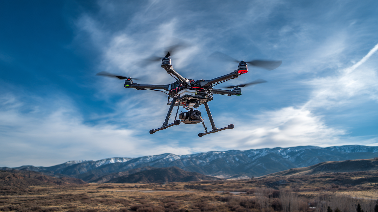
And it’s not just cars—drones also benefit a lot from IMUs. Take a leading drone maker, for instance—they added IMUs along with GPS to improve how their drones perform during delivery runs. When GPS signals get blocked, like when flying through tall buildings or urban jungles, the IMU keeps the drone on course by relying on those internal sensors. This combo really helps the drones deliver stuff faster and more accurately—even in tricky environments. All in all, IMUs are a game-changer, making autonomous navigation smoother and more reliable than ever before.
How to Leverage Imu Inertial Measurement Technology for Enhanced Accuracy in Navigation Systems - Real-World Applications: Case Studies Using IMU in Navigation Systems
| Application Area |
Technology Used |
Accuracy Improvement |
Real-World Impact |
Case Studies |
| Aerospace Navigation |
3-axis IMU, GPS Integration |
Reduced drift by 30% |
Improved flight safety and navigation precision |
Study on commercial aircraft navigation |
| Autonomous Vehicles |
Micro-electromechanical systems (MEMS) IMU |
Increased positional accuracy by 25% |
Enhanced obstacle detection and navigation |
Research on self-driving cars |
| Marine Navigation |
High-precision IMU with gyro compensation |
Improved heading accuracy by 40% |
Safer navigation in rough seas |
Case report on commercial shipping |
| Robotics |
Inertial sensors for motion tracking |
Enhanced positioning and orientation by 50% |
Increased efficiency in warehouse automation |
Experiment on robotic arms |
| Smartphones |
Sensor fusion with IMU |
Improved navigation accuracy by 20% |
Enhanced user experience in location-based services |
User study on mobile navigation apps |
Challenges and Solutions in Implementing IMU Technology in Navigation
So, when it comes to making navigation more accurate, integrating Inertial Measurement Units (IMUs) sounds like a great idea, right?
But, honestly, it's not all smooth sailing. According to a report from the National Academy of Sciences, while IMUs are pretty good at detecting movement and orientation,
they come with their own set of headaches—like sensor noise, temp swings, and drift that can really mess things up over time.
For example, if you don’t calibrate properly, your position estimates can be off by several meters in just a few minutes.
Yeah, that’s quite a gap!
Fixing these issues isn't straightforward—it's more like a puzzle that needs multiple pieces to fit together.
One of the key tricks here is sensor fusion. Basically, you combine data from these IMUs with stuff like GPS and other navigation tools.
That way, you can correct drift and get more reliable readings.
A 2022 report from the International Navigation Conference mentions that hybrid systems,
which use this sensor fusion approach, have boosted positioning accuracy by up to half—pretty impressive, right?
Plus, investing in top-notch sensors and smarter algorithms for processing data on the fly can really help tackle some of these problems.
All in all, it’s a mix of tech and smart strategies to make IMUs work better in navigation systems.
Future Trends: Advancements in IMU Technology for Navigation Applications
Lately, there’s been some pretty exciting progress in Inertial Measurement Unit (IMU) tech, and it’s really boosting how accurate navigation systems are getting across various fields. Thanks to integrating micro-electromechanical systems (MEMS) into IMUs, these gadgets are getting smaller and lighter, but still pack a punch in terms of precision. That’s a game-changer because it means better tracking of movement and orientation, even in fast-changing or tricky environments. You see these improvements everywhere—whether it’s in self-driving cars, drones, or your smartphone. The fact that IMUs keep shrinking and getting better means we’re heading toward navigation solutions that work really well, even when GPS signals aren’t strong or are totally missing.
Looking ahead, the future’s even more promising. Technologies like artificial intelligence and machine learning are starting to get involved, and they’re expected to take IMU performance to a whole new level. By crunching huge amounts of sensor data, they can help predict motion more accurately and catch faults faster—so the system can adapt on the fly. Plus, combining IMUs with other sensors like GPS and cameras—kind of like building a super-smart hybrid system—will make navigation super reliable and precise. Long story short, all this tech convergence is setting the stage for industries that depend heavily on super accurate location data to really take off and change the game.
Enhancing UAV Navigation Accuracy: Insights from Recent Industry Reports on the TBSD60 Inertial Navigation Sensor
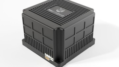
In the quest for enhancing UAV navigation accuracy, the Poseidon TBSD60 Inertial Navigation Sensor emerges as a frontrunner, backed by insights derived from recent industry reports. This state-of-the-art sensor integrates advanced digital closed-loop technology and features a high-performance fiber optic gyroscope (BSD) that ensures remarkable precision. With an outstanding zero-bias stability ranging from 0.01º/h to 0.05º/h, the TBSD60 is engineered to meet the rigorous demands of UAV applications. Reports indicate that such stability is crucial for minimizing drift in navigation systems, ultimately leading to more accurate positioning and trajectory prediction.
The TBSD60’s compact design, measuring only 112mm × 112mm × 77.5mm, makes it an ideal choice for integration into UAVs without compromising weight or space. Its rapid startup capability and wide dynamic range are essential for real-time data processing, allowing UAVs to adapt swiftly to changing environmental conditions. Recent statistics highlight that systems with superior resistance to vibration and shock, like the TBSD60, are significantly less likely to experience navigation failures during turbulent flight. This resilience is particularly advantageous for operational environments that demand precision, such as industrial automation, autonomous vehicles, and complex UAV missions.
Moreover, industry analysis suggests that the growing use of high-precision inertial navigation systems will further propel the demand for advanced sensors like the TBSD60. With the increasing complexity of UAV missions and the necessity for reliable navigation technology, equipping UAVs with such sophisticated sensor systems is not just beneficial but imperative for meeting evolving operational standards in aerial navigation. The Poseidon TBSD60 exemplifies the intersection of innovation and precision engineering that is reshaping the future of UAV navigation.
FAQS
: An IMU is a device that integrates accelerometers and gyroscopes to provide precise motion tracking and orientation data for navigation systems.
IMU technology enhances the accuracy and reliability of navigation systems, allowing them to operate independently of external signals like GPS, especially in environments where these signals can be compromised.
The global IMU market is projected to reach $10 billion by 2025, driven by increased demand in sectors like aerospace, automotive, and portable electronics.
Poseidon International Group is involved in the research and development of advanced inertial navigation systems and fiber optic gyroscopes, utilizing IMU technology to improve navigation solutions across various applications.
A major automotive manufacturer has integrated IMU technology into its self-driving cars, allowing them to navigate complex urban landscapes with improved reliability, particularly in GPS-denied environments.
IMUs stabilize flight and improve trajectory tracking in drones, ensuring that they can maintain their intended flight path even in areas where GPS signals are obstructed.
IMU technology is essential for modern applications that require high levels of reliability and integrity in data, enabling accurate navigation in various challenging environments.
Industries such as aerospace, automotive, and portable electronics are benefiting from the advancements brought about by IMU technology.
IMUs continuously measure acceleration and rotational rates, providing real-time data that enhances a system's ability to make swift adjustments for improved safety and efficiency.
By integrating IMUs with GPS systems, delivery drones can maintain accurate payload positioning and ensure timely deliveries, even in challenging environments where GPS signals may be weak.
Conclusion
The article titled "How to Leverage IMU Inertial Measurement Technology for Better Accuracy in Navigation Systems" really dives into the basics of IMU tech and why it’s such a game-changer for modern navigation. It highlights the main perks of combining IMU inertial measurement with GNSS — basically showing how this combo can boost accuracy and make systems way more reliable. The piece also talks about how tweaking sensor fusion methods can really improve the quality of navigation data. Plus, it shares some real-world examples of companies successfully using IMU tech, along with the challenges they faced and possible ways to overcome them.
Looking ahead, the article predicts more exciting developments in IMU technology, especially when it comes to companies like Poseidon International Group (Hong Kong) Limited, which has a strong focus on inertial navigation systems. Given their work with fiber optic gyroscopes and autonomous driving tech, Poseidon is definitely positioned to push the boundaries and make navigation even more precise with innovative IMU solutions.
 TBSD60
 BSD120
 BSD98
BSD98 BSD70
BSD70 BSD60
BSD60 BSD50
BSD50 BSD217
 INS1700
 INS970
 INS570
 INS170
 SLA-4B1L1-65
 SLA-4B1L1-130
 SLA-8B1L1-165
 DIVER 101
 DIVER 102
 DIVER 103
 DIVER 104
 DIVER 105
 DIVER 106
 SLLR3000
 SLLR905
 SLLD25
 160M
160M 170M
170M SLFC-70
 SLAF280
 MR360
MR360